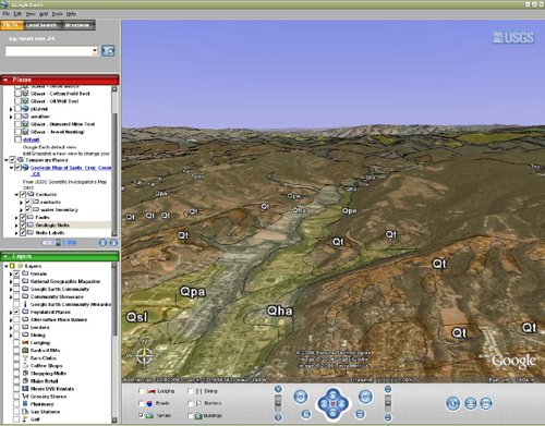
Covered this morning in the Google Earth Blog is the introduction of a series of geologic maps for Northern California in Google Earth KMZ format. Produced and distributed by the United States Geologic Survey (USGS), these maps depict the bedrock geology for 12 counties.
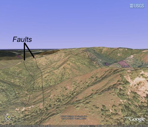
The network link from the USGS includes the geologic units and their abbreviated formation name as a label. Interestingly, the link also includes place markers for faults, in this case all 710 faults in Santa Cruz County, geologic contacts, and water contacts. If course the transparency can be adjusted to merge the geology with the underlying imagery or you can add your own imagery to start some analysis.
Digital bedrock geology maps can sometimes be a pain to find for a study area and unless yours is in North California, this may not help you. But the direction that the USGS is taking here is clear. Data in Google Earth format is very easy to use, free or cheap, readily available, and fun to explore. Given the abilities of Google Earth to add your own imagery and the number of converters that can put GIS and 3D data into Google Earth (KML Home Companion(ArcGIS), Arc2Earth, Maya2GoogleEarth, to name a few) archaeological, Heritage management, and conservation groups should be taking full advantage of this technology. Although the analysis capabilities are simple (ArcGIS Explorer may change this) the data exploration, display, and dissemination aspects are tremendous. With a little bit of conversion and rubber sheeting, specialized information can be deployed to nearly any audience. It seems pretty apparent that with so many people realizing that maps make a fantastic vehicle for all kinds of information, spatial thinking will prevail and the technology will follow.
These maps are in an effort to disseminate geologic information and awareness in light of the 100th anniversary of the 1906 San Francisco Earth Quake.
No comments:
Post a Comment