Friday, May 05, 2006

Comparing NASA to Archaeology?

"He [Burt Rutan] likened NASA’s efforts to archeology.”

- author Leonard Spitzer, Space.com

How exactly do you compare NASA to archaeology?

The context of this quote is Burt Rutan, head of California based, Scaled Composites, a privately funded space exploration design and construction firm, commenting on the current state of technology at NASA’s Crew Exploration Vehicle project. This project is the key to NASA’s moon and mars initiatives as outlined by President Bush’s “Vision for Space Exploration.” As stated by Rutan, the comparison to archaeology follows that:

“They [NASA] are forcing the program to be done with technology that we already know works. They are not creating an environment where it is possible to have a breakthrough … It doesn’t make sense,” Following this, Rutan argued that the NASA program needs to take risks in order to come upon a breakthrough.”

Now, unless Rutan is experienced in the world of Cultural Resource Management (CRM), the comparison is a bit foggy. Perhaps he is saying that NASA is using old stuff, archaeologists like old stuff, therefore NASA is like archaeologists. That interpretation seems a bit weak for a rocket scientist like Rutan.

I would like to think that the comparison is a good bit deeper and quite accurate from my perspective of working in the CRM industry. As with NASA, most of the work I do for a CRM company is funded, in one way or another, by a government agency. Also, as is the case with NASA, funding dictates the degree to which technology and innovation can be brought into a project. So as Rutan said, the perceived risk of loosing money to technology stifles new breakthroughs and in the end, costs more money.

Although I do get to work on some very cool and techy projects, in CRM in general, there is a lack of technological applications. Don’t get me wrong, technology is applied in some very cool ways and by very smart people, but the run of the mill phaseI/II investigation, which a huge portion of projects are, are relatively devoid of technology more recent than the trowel and shovel.

“So what” you say, the trowel and shovel work just fine and get the job done. I agree, but the point is, try and step out of the box and chances are you will be shot down. Whereas archaeology will always need the shovel and trowel, usually as a precursor to a bulldozer and grader, there is a host of technology that can work with the process to make the end product more accessible, accurate, and cheaper.

A creative environment is a hard thing to fund is CRM. The trickle down of process and methodology from the academy is a good, but implementing is in a quick and cost effective way, quickly and cost effectively, can be a challenge. I’m sure NASA faces many of the same hurdles. If this is what Rutan meant, then I whole heartedly agree.

Whereas Rutan said he would not want NASA Chief, Mike Griffin’s job of making President Bush’s space vision work give “only pennies to do it.” As an archaeologist in CRM, I truly enjoy the challenge.

Thursday, May 04, 2006

Site News: The CRMGIS blog is moving: www.gisarch.com

I am ready to make the big move to a new domain, I think?

The new site http://www.gisarch.com is up and running. There are a handful of cosmetic changes to be made, but the content is there. The RSS feed from Feedburner has been moved. If anyone is subscribed via anything but feedburner, please visit the new site and reconnect. Sorry for the inconvenience.

I hope that the new publishing platform, WordPress, will give me more flexibility in layout and content features. Also, I hope having a more relevant domain name will help create an audience.

I will continue to post on both site for the time being. This is for folks who arrive here via established links or bookmarks, as well as, keep up the archives that readers may be linked to.

Feel free to email me ( admin /at/ gisarch /d0t/ com) with any issues about the move or any problems with the new site. I would appreciate it. Thanks!

Mass Mapping the Isle of Wight

This morning, OpenStreetMap was covered on the hugely popular Boing Boing blog. The post, linked to a full story at digital-lifestyles, describes the critical mass like effort of 30+ mapping enthusiasts who plan to map the Isle of Wight off the UK coast. The effort will produce a spectrum of spatial data that will be distributed under the Creative Commons license.

The intention, beyond gathering good data, is to show that is does not take a government entity, e.g. the Ordnance Survey, to bring spatial data to the people. Great project, I can't wait to see the results.

Wednesday, May 03, 2006

Archaeology of a 1945 Prison Escape ... Part 1

The Story of the 1945 Escape Tunnel

On April 3rd, 1945, 12 men escaped from the Eastern State Pennitentary in Philadelphia. Among them, was the notorius bank robber, "Slick" Willie Sutton. Sutton, as well as the tunnels engineer, Clarence Klinedinst were caught very shortly after the escape. Within 2 days, all then men were back in the prison.


On April 1st, 2006, the tunnel was cleary seen again for the first time in 61 years.


Although, I am late to the game, since this story has been covered by ArchaeologyNews, the AP, NPR, and a slew of newspapers and blog, I figured I should tell my side of the story since it was my companies job to find it.

The story goes, prior to the escape, Clarence Klinedinst, being a mason, was tasked with replastering the walls of cell block 7 (SW arm in this live.com view). After completing this task, he bargained with the officials to give him his choice of cells, he chose cell #68. Incarcerated by him self, he began a project that would take him over a year to complete. Beginning with a specially placed thin plaster wall, which he created during his replastering duty, he began his dig to freedom.

Cell #68 is located at the distal end of 
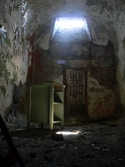
cell block 7, with nothing but 100ft of courtyard, and a 30 foot wall between it and the outside. Clarence Klinedinst (aka Kliney), began to dig, at first by himself then later with a cell mate, into the wall and straight down to the sand sediment below. Once Kliney was into the wall and through the footer, there were no obstructions until he would encounter the 12 foot deep base of the prison wall.

Digging for close to a year and a half, Kliney and his cell mate alluded suspicion. Taking turns digging at night, one prisoner would sleep while the other dug. Paper Mache heads were constructed to fool the ever watchful guards. At first, the prisoners disposed of the rock and soil in the cell toilet and in the yard. After a number of feet was dug from the tunnel, a brick sewer pipe was encountered and used to discard the dirt.

The tunnel was well planned and equipped with an electrical lighting system and wooden bracing. to help keep its integrity. Heading level across the yard, the tunnel was dug to the base of the outer wall and then dug down ~5 feet to get below the walls footing. At this point, the tunnel was excavated through the water table of an old stream that used to flow across the area, before it received 15 feet of fill to level the prison yard.

This stream was part of the escape undoing. On the morning of April 3rd, Kliney, his cell mate, Slick Willey, and 9 other opportunists made a mad dash through the tunnel and out the tiny exit hole on the corner of 22nd and Fairmount. With clothes wet and muddied from crawling though the water filled depression under the wall, the police had little difficulty following the tracks and capturing the crooks. All were hauled back to jail, and one of America's greatest escape stories was born.

In the second part of this post, I'll go over the technology and archaeology that were used to find the tunnel... stay tuned

Site News: Working on new CRMGIS blog

Soon, I will be moving the "GIS for Archaeology and CRM" to a new home. I have secured a domain (www.gisarch.com) and I am working on configuring WordPress. Hopefully this move will offer a better site with little inconvenience to the readers. I suppose a few issues will need to be ironed out with RSS and such, but it shouldn't be too painful.

I'll be sure to keep you posted...

Monday, May 01, 2006

Bosnian Pyramid: Google Earth Used to Disseminate Data

Photo Credit: http://www.bosnianpyramid.com/

What are the chances of the world’s tallest man-made pyramid being found in Visoko, Bosnia-Herzegovina? Well, according to the data and available studies on the BosnainPyramid site, at least somebody believes it. Although, the intention of this post is not to support or debunk the authenticity of this find, but instead, just to point out an example of a project (albeit off-beat) using Google Earth maps and links, as well as, a blog’ish publication scheme to produce data that can be accessed by many and, in this case, be swept up into a media whirlwind.

(This article from Archaeology Magazine will give the stance that many professionals take on this issue)

A little background on this site tells quite an interesting story. The 2,120 ft peak of Visocica, towering over the small town, has been noted for its four sided geometric shape long before the recent excavations. Stories going back the 14th century describe a hidden subsurface structure that once housed the Bosnian king, Tvrtko of Kotromanic. Much more recent reports include the uncovering of engraved building blocks and other faced stones in the constructions of roads and a foundation.

In comes Semir "Sam" Osmanagic, a Texas businessman with an appetite for the weird and wonderful aspects of “archaeology”. Semir, of Bosnian descent, has believed for 15 years that Visocica is the location of the world’s largest man-made pyramid. Now, with a government supported 5 year excavation and a swell of nationalistic pride in his court, Mr. Osmanagic seeks to prove to the world that he has found what he promised. Brushing aside the pleas and claims to halt excavation, by well established archaeological professionals, Mr. Osmanagic presses on.

The website dedicated to the Bosnian Pyramid Archaeological Park, with a clean 3-column design, provides updated content, stories, relevant research aspects (geology, remote sensing, etc…), and a section of maps and KLM downloads ( Sun Pyramid). Fitting well with the Indiana Jones feel to this project, the Google Earth links quickly transport the viewer to the location of the alleged pyramid. Also, there are links to other “pyramids” and a rubbersheeted topo map that gives a decent indication of the topography. How long before someone places a Google SketchUp model on the spot?

Although the technology is nothing fancy and the presentation is simple, the 595 views of the pyramids GE placemark on the keyhole site is probably more looks, virtual or actual, than most archaeology sites will ever see. Certainly, it is the highly controversial and compelling story that created the media frenzy around this “find”, but the availability of data in the form of flying into and around GE placemarks and raster overlays helps get the point across.

Minnesota Historic Plat Maps Online


Cover this morning at The Map Room blog, the Minnesota Historical Society has scanned and made available a large collection of historic maps ranging from 1848 to 1907. The online collection is drawn from the society’s archive of 19,000 maps and 2000 atlas volumes. The main archive contains map dating back to 1581.

The online version of this amazing catalog contains plat maps and atlases created by the General Land Office and the Bureau for Land Management. The plat collection is searchable by county or township/range. The scanned atlas editions include a statewide coverage, as well as, Dakota, Hennepin, Ramsey, and Winona Counties.

I am not sure how recent the addition of the online map resources is, but I thought it may be useful to the handful of Minnesota readers.