Tuesday, April 04, 2006
Robots, Prisoners, Lasers, and 18th Century Grist Mills


Friday, March 31, 2006
News brief: Google includes ads in Google Local
A Search for "Ralph Lauren NY" turns up an example of this new ad technique (is that the ICQ chat icon?). According to an article at CNET, the ad icons will not be included in Google Maps accessing the API.
Wednesday, March 29, 2006
PerryGeo: Top 10 WMS list
The 10 WMS layers compiled my Matt Perry are a set of key base layers that can be pulled together in a web mapping interface such as MapServer, BeeldBlab, OpenJUMP, ArcIMS.
Also, Matt's blog post includes tips on displaying data availability and a slick MapServer app with the included mapfile.
Check out the rest of PerryGEO for some great nuts and bolts GIS, including a way to script a KML to Shapefile converter!
GPS + Camera + Google Map = Fantastic Field Survey Tool
Although, the idea of a GPS enabled camera has been floating around for a while, this is the first time I have seen productive results in a method that is easily reproducible (thanks to IceBurn's sharing of his Exif data to XML Perl script). Such a technology would be a boom for many types of field survey. Particularly, this tool would be incredibly useful in Historic Resource survey. Unless you are using handheld field data loggers, you are probably heads-up digitizing your locational info from a paper map or even Geocoding addresses. Then, photos needs to be renamed from photologs and plugged into your GIS by any number of ways. With the locationally aware camera, metadata could be associated with each photo via the ability to include Exif data or the GPS units data logger. With a script similar to IceBurn's Perl script, your location and photographic data is one step away from production. I can already hear the client's giddy laughter as the click a link and up come a Google Map with the days survey results published within a half hour of completion.
Stop by IceBurn's liar to check out his Geo-Camera and the great examples he has posted.
Edit: After doing a little searching I found the Richo Pro G3 GPS Camera. Including CF WAAS GPS, Bluetooth, and ESRI ArcGIS software to take care of all the dirty work. Very cool!
Monday, March 27, 2006
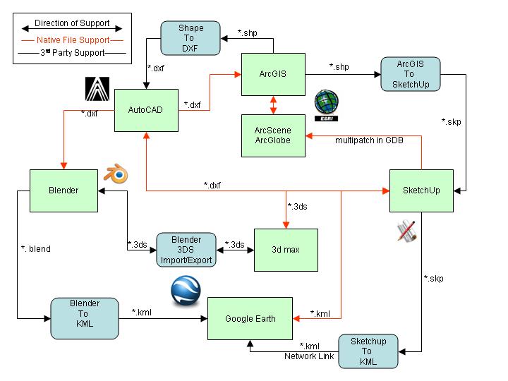
Conversions and 3D visualization on the Cheap
 click image for larger view
3D Studio Max
ArcGIS
ArcScene/ArcGlobe
AutoCAD
Blender - Open Source
Google Earth - Open Source
Sketchup
DXF Author (ESRI Shapefile to DXF) - Open Source
Shapefile to Sketchup - Open Source
Blender 3DS Import/Export - Open Source
Blender to KML - Open Source
Sketchup to KML - Open Source
*Please note: I do not endorse these products. I am in no way affiliated with any of these products. I use this software for my day to day work and I though someone may get use out of this information.
Sunday, March 26, 2006
Location Technologies and Archaeology Sites
map loading...
The best and the worst thing about archaeology sites is location. Knowing the location of a site or multiple sites can help create models to find more sites and/or better understand what we know about a site. At the same time, archaeological site location is highly secure data. This is for the sites protection. There is a lot of money to be made on archaeological artifacts.
Here is the location of my favorite archaeological site. I may be breaking a rule by showing this, but it doesn't really matter. Since, Google Maps is living in the past, you wouldn't know that this site is now covered in dozens of high density housing units. Any potential scavengers would find nothing here except golf balls the folks shanked them.
I guess my point is, to me, archaeological sites are much more than just a point on the landscape that has artifacts buried in the dirt. Each is a place. Each has a personality, a view, a feel. There are numerous websites popping up lately that integrate places and commentary. Platial "The Collaborative Atlas", for example, is well known. It would be ideal to share with people the places I love and why feel that way about them. Beyond that, archaeological sites are a part of a town, state, county's heritage that belongs to everyone, not just a privileged few. Archaeological sites deserve to be part of an atlas. With people opening up their minds to spatial thinking and taking in new aspects of the environment, I would argue that archaeological information would be of interest. Anything to get people interested in archaeology should be pursued
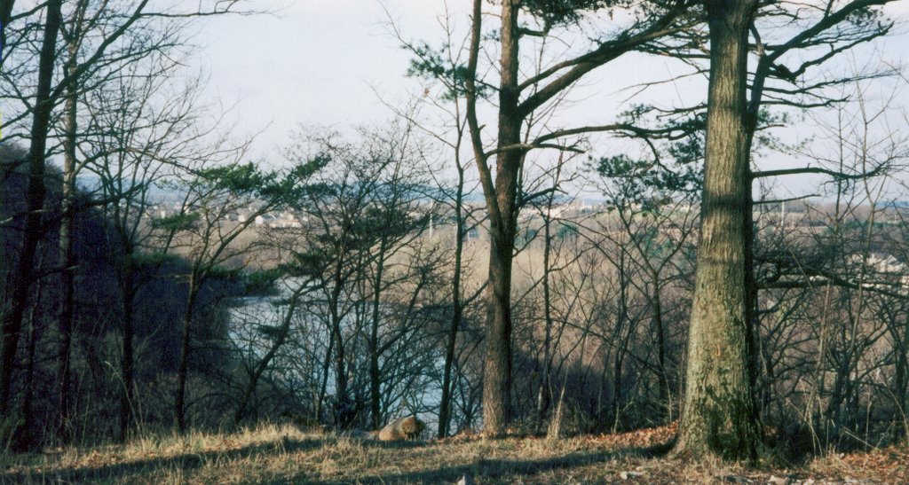
This is a pretty big topic in American archaeology. We want everyone to enjoy and learn from these sites. We preach that they belong to everyone and that justifies why we spend money to excavated them. But we secret them away because the integrity and intactness of the sites is the key to being valuable. So in the end, I can only show this place because it is gone.
Saturday, March 25, 2006
Google Map of Excavations in Flanders
This project represents a first look at what will probably be a pretty common method of deploying archaeological information. One certain advantage is the price and efficiency of using the Google Maps API. Benefiting most from such efforts will most likely be heritage tourism sites. The ability to locate and access information on public excavation and interpretation efforts from an intuitive and common interface will help bring in the people.
A paper [Abstract] on this project is scheduled for presentation by Vereenooghe Tijl (Catholic
 University Leuvwn, Belgium at the Computer Application and Quantitative Methods (CAA06) April 18th. I will be talking much more about this conference and certain papers throughout the next few weeks. Held for the first time in the United States, the CAA06 is an international showcase for the use of technology in archaeology.
Thursday, March 23, 2006
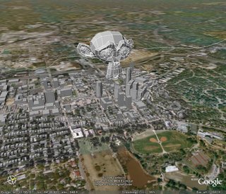
Export Blender 3D to Google Earth KML
Check out A Life of Coding for the script and installation insrtuctions.
Below is an image of the example KML provided by Ynniv.
Middle Atlantic Archaeology Conference
Wednesday, March 22, 2006
Getting your feet wet
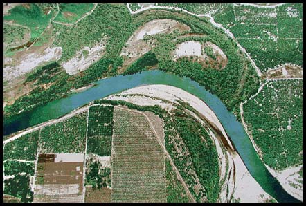 Recent fly-over of the Delaware River?
Created in a very interesting context of movement, destination, and belonging, Seyed states that his geographical tapestry is also intended for humor. Check out his description of the work.
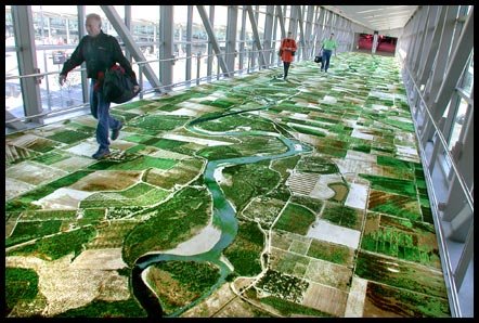
Visualizing 200 years of utilities in the UK
Much to the appreciation of UK archaeologists, a new program entitled VISTA (Visualizing integrated information on buried assets to reduce streetworks) aims to map the roughly 1.5 million kilometers of gas, sewer, water, and electricity utilities now in place under the their streets. With a significant portion of these conduits being nearly 200 years old, current knowledge of their whereabouts is sketchy at best (diagram below shows the complexity of utilities). 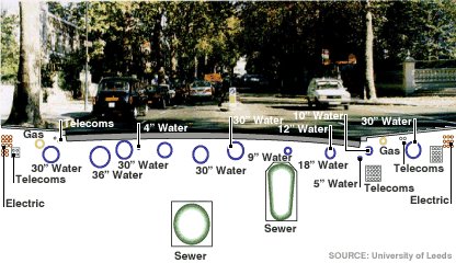
Tuesday, March 21, 2006
Spatial Data Standard for Facilities, Infrastructure, and Environment (SDSFIE)
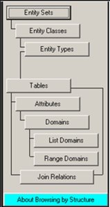
First, take a look at the data structure of the SDSFIE. The hierarchy starts with the "Entity Sets" which houses numerous "Entity Classes", down to "Entity Types", which contain "Attribute Tables", defined by "Domain Tables". To put this in ESRI lingo:
Entity Classes = Feature Data Sets
Entity Types + Attribute Tables = Feature Classes
The SDSFIE comes prebuilt with a host of Entity elements in place. Generally, these are Entity sets, types, and classes that the DoD felt useful in organizing their facilities and structures, but they are not exclusive to the military. There are a total of 26 Entity Sets, 185 Classes, and 1,122 Types as of the most recent SDSFIE release (2.5). The Sets include Buildings, Geology, Ecology, Communications, and Cultural. I will demonstrate an example using the Cultural Entity Set in a moment. From these sets, the classes and types become more specific.
 The Browsers are used to browse the data structure to find attributes and relationships. The Filter Maker is used to create a filter of the data structure for fast and efficient database creation. The Builders/Generator are used to create the database, using filters or manually, for a given application. And the Loader is used for data entry. Also handy is the web based Browser and Filter maker. Use this to take a walk through the data structure.
Here is a quick example using archaeology:
Entity Set: cultural
Entity Class: cultural_archaeological
Entity Type: archaeological_artifact_point
Table: crarcart
Discriminant Domain: art_type_d
Domain Values: "Fire_Rock", "General", "Unknown"
The table "crarcart" is used to locate and define "Objects or archaeological significance which, due to their size or nature, have not been removed from the site." In an implementation of the SDSFIE, this table would be used in relation to classes representing archaeological sites, testing areas, sensitive areas, cleared areas, and installations.
Creating filters and GDBs takes a little getting used to, but fortunately, there is a free online "Basic Training" available. This consists of 15 short courses which culminate in a quiz and a printable certificate of completion.
Monday, March 20, 2006
Fun with Google Earth and Archaeology
The most recent archaeological site in question (#22) is:

Saturday, March 18, 2006
GIS and Archaeology Conferences
Computer Applications and Quantitative Methods in Archaeology (CAA 2006):
- The international CAA 2006 is being held for the first time in the United States. Way up in frosty Fargo, North Dakota, this looks to be a killer conference. Sessions range from the use of Google Earth and Wikipedia as archaeological tools, to modeling, 3D visualization, Digital libraries, simulation, and theory to name a few.
- Following current trends, the PAGIS 2006 conference, held in Camp Hill, PA, is entitled, "Earth, Arc, Google, and Beyond: The Mass Commercialization of Geospatial Technology, Where Can It Take Us?" I will certainly attend this showing. Although, not CRM related, I'm sure I can work it in there somewhere.
- Last year this was a great regional conference and I anticipate the same this year. Focusing on the use of Geospatial technologies to study and react to the way in which people have changed the landscape, there should be some good papers on ecology, landscape studies, transportation, and cultural resources. If any one is in the area of Newark, Delaware, stop on by.
Friday, March 17, 2006
Philadelphia GeoHistory Network
New updates to the
The Greater Philadelphia GeoHistory Network (GPGN) is an initiative to create a web-based portal of the full range of geographic and document data concerning the history culture and architecture of the city and surrounding area. The idealized product is a free resource that anyone can use for researching Philly’s history.
The GPGN site, has recently been updated with transcripts of the December planning meeting’s working groups and PowerPoint presentations. Also, there are links to some of the already digitized cartographic base data.
If you are interested in Historic GIS, check out the presentations link on the GPGN page. There are some cool presentations by Anne Kelly Knowles (Middlebury College), Lex Berman (China Historical GIS), and Amy Hillier (UPenn) to name a few.
Getting into the Mood...
Often times I am tasked with creating a seemingly endless number of indexed maps, atlas style. Since ESRI has not yet to hold my hand through the post "multiple layouts" of the ArcView 3.X days, I have *.mxd files coming out the ears. I have tried the Map Book developer sample in the past, but lost then when I upgraded to Arc9. I know, I know, I have to understand that it is a change in work flow, not a change in application design. There needs to be a middle ground between endless layouts and endless bookmarks or *.mxd files.
Anyway... The point is, in order to get into the mood of doing this repetitive task, I like to put on some good map making music. What is good map making music? Good question.
To me it is something I’m familiar with, but that is not drilled into my head. It's like hearing new thing and going on a musical adventure, but not having to pay attention to the point of screwing up the scale bar. I think good map making music has a solid tempo, but not too fast or two slow. Speed Metal makes me rush through maps and make mistakes, Dream Pop or Show Gaze makes me fall asleep. I like something mid-tempo with a few punches of drama and energy.
I would discourage politically and socially charged lyrical bands for map making music, especially if you are working with non-environmental maps. Thinking about "the MAN" while confining your mapping art to arbitrary and political boundaries can just send you over the edge. You might even start to tweak boundaries as your way of "bringing the system down from the inside."
The following albums are on the short list of what I consider good map making music. One of these lucky bands will make it into my Foobar 2000 playlist before I take flight into cartographic bliss.
In no particular order:
- Arctic Monkeys - Whatever People Say I Am, That's What I'm Not
- good for maps of social interaction
- Bloc Party - Silent Alarm
- good for maps of dark corners
- The Decemberists - Picaresque
- good for maps of the high seas and treasure maps
- Iron & Wine - Women King
- good for low relief maps
- numbers - Death
- good for mapping information networks/systems
- Sufjan Stevens -
- well, good for mapping the upper
- Clap Your Hands Say Yeah - Self Tilted
- good for mapping your inner David Byrne
Well, something there should strike my fancy. If anyone of you have suggestion for dealing with multiple layouts or, more importantly, good map making music, let me know!
Thursday, March 16, 2006
Bits in the Wind...
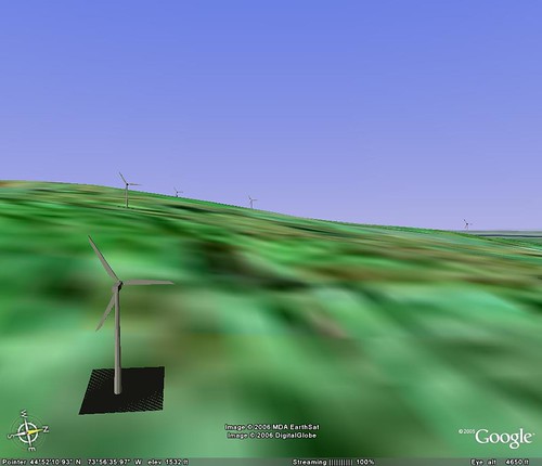
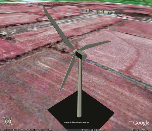 I was working this morning on quickly putting together a visual for a wind turbine project. Here are two captures of "progress". These images are form google earth with imports of data from ArcGIS and Sketchup 5. I could write all day about how incredible SketchUp is. Interestingly, the makers of Sketchup, @Last, were just bought by Google..
Since I am not a big fan at all of the use of the term "Mash-up", I'm going to call my Google, ESRI, Sketchup project, a "Smack-down". I'll have to use that one again!
Check out this great post/tutorial at Juicy Geography to see where I "borrowed" some indspiration from.
First Post
Well, I guess "Hello World" will have to do.
My intention: to create a home for GIS/Geo Spatial/Spatial Tech ideas and general ramblings.
Focus: the general focus will be towards how GIS is used in archaeology and particularly the realm of Cultural Resource Management (CRM).
Goal: create an environment to foster discussion and distribute information.